Nabatieh attacks map
In the last 12 months 1966 armed incidents were reported in Nabatieh Province, Lebanon on the battleMap live map, most often shelling, air strikes and explosions (1711) and casualties and rescue (153). The busiest month was March 2026 with 749 reports. In the last 30 days: 45; the latest report is from 2026-11-11. These are counts of public reports, not verified losses.
 Open the live map →
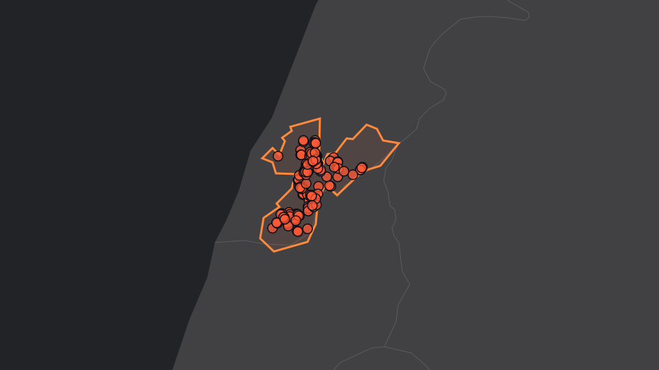
Dots: incidents reported in the last 90 days. The live map shows each report with its time and source.
Latest reports
- Israeli artillery fire targeting outskirts of Mefdon, south of Lebanon · shelling, air strikes and explosions · Nabatieh · twitter.com
- Artillery attacks Wadi al-Sawqa and Wadi Zebqin, and the outskirts of Zawter Sharqiya · shelling, air strikes and explosions · Nabatiyeh Governorate · twitter.com
- Israeli strike targets Wadi al-Saluqi · shelling, air strikes and explosions · Nabatiyeh Governorate · x.com
- Israeli artillery fire intermittently targets the area of Sawwan near the town of Mefdon. · shelling, air strikes and explosions · Nabatieh · x.com
- Israeli forces strike targets Talusah · shelling, air strikes and explosions · Nabatiyeh Governorate · x.com
- Israeli warplanes launched a series of raids targeting the towns of Kafr Tabnit and Markaba. · shelling, air strikes and explosions · Nabatiyeh Governorate · x.com
- Israeli warplane strikes outskirts of Bani Hayyan village · shelling, air strikes and explosions · Nabatiyeh Governorate · x.com
- Lebanese Health Ministry: One killed, one injured in Israeli raid on motorbike in Marj'ayoun · shelling, air strikes and explosions · Nabatiyeh Governorate · x.com
- Israeli airstrike targets Wadi al-Hujair area in southern Lebanon. · shelling, air strikes and explosions · Nabatiyeh Governorate · x.com
- Lebanon's health ministry confirms that one person was killed and another was wounded in an Israeli drone strike on a motorcycle in the town of Qabrikha in the country's south this afternoon. The slain man is identified in reports as Muhammad Nasser Yousef, a paramedic with the Hezbollah-allied Amal movement;s Risala Scouts.The Israeli army has not yet commented on the strike, the first in Lebanon in weeks. · casualties and rescue · Nabatiyeh Governorate · t.me
- Israeli strikes and explosion in Al-Tiri, southern Lebanon. · shelling, air strikes and explosions · Nabatiyeh Governorate · x.com
- Israeli airstrike targeted Wadi al-Hujair · shelling, air strikes and explosions · x.com
- Airstrikes target outskirts of Barashit · shelling, air strikes and explosions · x.com
- Explosion of drone in two houses in Mefdon, no injuries reported. · drone attacks · x.com
- Israeli artillery shelling targets the area of Arza, southern Lebanon · shelling, air strikes and explosions · Nabatiyeh Governorate · x.com
- The Israeli army shelled a house in the town of Kafrshouba and shelled the surrounding area south of Lebanon with artillery · shelling, air strikes and explosions · t.me
- Intermittent shelling by Israeli army the targets the area between the towns of Mefdon and Zawter · shelling, air strikes and explosions · Nabatieh · t.me
- Israeli strike targets two platoons in Kafr Tebnit · shelling, air strikes and explosions · Nabatieh · x.com
- Israeli military aircraft launched an air raid on the outskirts of Bar'shitt. · shelling, air strikes and explosions · Nabatiyeh Governorate · t.me
- Israeli attacks reported from midnight to present: Qantara, Kafr Tebnit, Zawter Sharqiya; Counter-battery fire: Al-Mansouri, Wadi Al-Hajar · shelling, air strikes and explosions · t.me
Kinds of incidents, last 12 months
- shelling, air strikes and explosions1711
- casualties and rescue153
- ground fighting57
- drone attacks17
- police and arrests13
- air defence and alerts7
- fires5
- missiles and rockets3
Reports by month
The current month is incomplete.
Places named in the reports
- Nabatiyeh Governorate14
- Nabatieh4
Questions
How many attacks were reported in Nabatieh Province, Lebanon? 1966 incidents in the last 12 months and 45 in the last 30 days, counted from public reports placed on the battleMap map.
What counts as an incident? Shelling, air strikes and explosions, drone and missile attacks, air defence activity, ground fighting, casualties, fires and police actions. Political statements are not counted here.
Where does the data come from? From publicly reported events with a time, coordinates and a source; the area is worked out from the coordinates. See the methodology.